Center for Natural Hazards Research: Preventing and Mitigating Complex Disasters
Research Highlight | April 07, 2021
This article was published in the Spring 2020 issue of Litterae Populi. The full list of articles can be found here.
If the lifeline system of a snowy area is damaged by an earthquake, or if a river is dammed by a pyroclastic flow following a volcanic eruption and thereby causes a flood, what should be done to proceed with rescue efforts and the recovery of livelihood in the stricken area? The Center for Natural Hazards Research has started operations as a base for the prevention and mitigation of complex disasters.
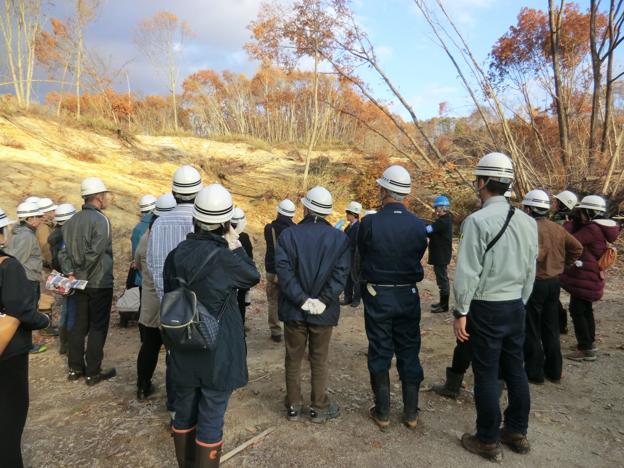
Director Yamada explaining the flow status of collapsed sediment to local residents (Symposium and site tour held jointly with Atsuma Town).
Typhoons, heavy rain, heavy snow, earthquakes, tsunamis, eruptions or other natural disasters may occur consecutively, or cause avalanches, landslides, ground liquefaction, floods, facility damage, traffic hindrances or other secondary disasters. Multiple natural disasters causing serious loss of lives and assets as well as damage to logistics and the economy are called widespread natural disaster with multiple hazards. For example, when three typhoons hit Hokkaido in the span of a week in August 2016, rivers overflowed and inundated farmland. At the time of the Tokachi-oki Earthquake in March 1952, drift ice carried by a tsunami caused houses to collapse.
The Center for Natural Hazards Research was established in April 2019 to find ways to prevent and mitigate such widespread natural disaster with multiple hazards. Its predecessor was the Laboratory of National Land Conservation, which was an endowed course of the Research Faculty of Agriculture. At the Center led by its director, Professor Takashi Yamada, 26 members including three full-time teachers and other teachers from the Faculty of Engineering, Research Faculty of Agriculture, Faculty of Science, Faculty of Humanities and Human Sciences and Arctic Research Center get together and engage in R&D, disaster prevention education, provision of technical advice to local governments and other activities.
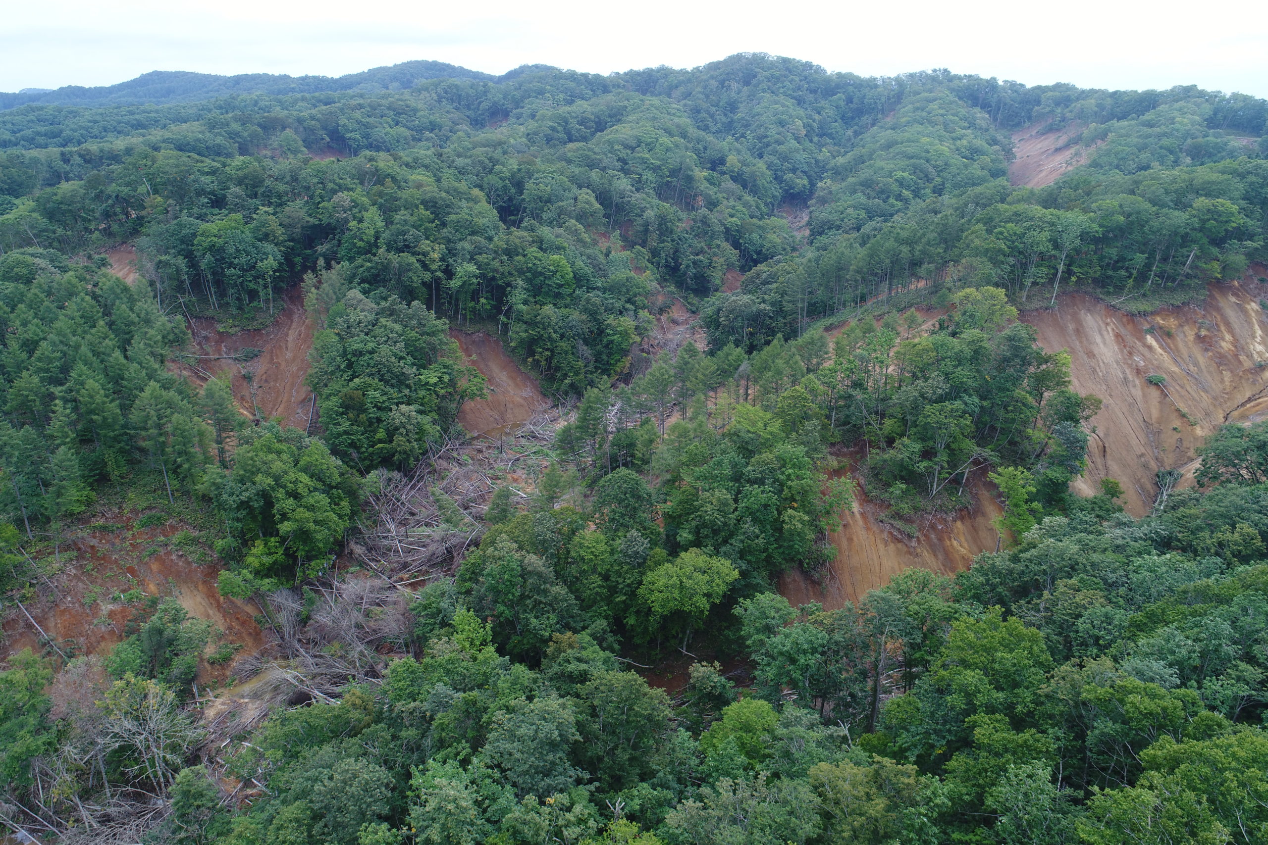
Shallow landslides caused by the Hokkaido Eastern Iburi Earthquake on September 6, 2018 (Atsuma Town, Yufutsu-gun, photographed on August 20, 2019).
Widespread natural disaster with multiple hazards cause social problems, such as the collapse of social infrastructure, economic stagnation associated with disturbances in logistics and the outflow of population from the stricken area, in addition to damage caused directly by the disasters. Their influence may not be limited to the stricken area, instead spreading to all parts of the nation and even to the world through supply chains that involve industries in the stricken area. Therefore, the Center addresses research subjects related to a wide range of academic fields, such as public policy and economy, in addition to the elucidation of the disaster occurrence mechanism and the development of disaster-prevention technologies. The ability to externally provide practical disaster prevention and mitigation measures is one advantage of the university having researchers from such varied fields. On campus, General Introduction of National Land Conservation and General Introduction of Risk Management on Sudden Complicated Disasters are included in inter-graduate school classes. Teachers from the Center specializing in different fields take turns giving lectures characterized by multi-faceted approaches. Off campus, the Center conducts outreach activities in cooperation with local governments, including symposiums and site visits to look back on the Hokkaido Eastern Iburi Earthquake and discuss future disaster mitigation and recovery.
Preparedness for natural disasters in Hokkaido
Natural disasters are increasingly intensifying throughout the nation. Since Hokkaido has had relatively few large- scale disasters, it has little experience with heavy rain and measures are insufficient in many aspects. It is necessary to make preparations for disaster prevention and mitigation, including the preparation of hazard maps and other activities during normal times, preparation to respond promptly to emergency rescue needs immediately after disasters and planning for recovery and reconstruction assistance based on a long-term vision.
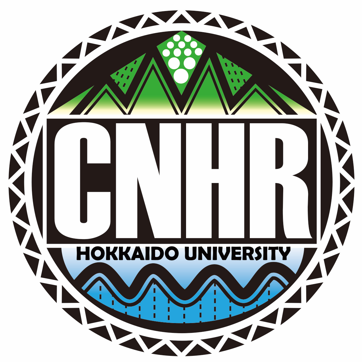
Logo of the Center, designed by Associate Professor Takashi Koi. The logo features rain, wind, snow and seismic waves in mountainous areas (top), meandering rivers and sea waves (bottom) and living spaces (i.e., houses; the square surrounding the CNHR logo and the triangle (roof) on top), snowy Hokkaido mountains on the edge and a black background representing outer space (monitoring from a satellite)
Disaster-prevention efforts are being made by universities and other institutions throughout Japan. In Hokkaido, its vastness and cold climate are important elements when considering disaster-prevention measures. While its vastness is advantageous for agriculture and other key industries, it also poses major challenges, such as securing traffic access from the starting points of rescue missions (e.g., adjoining cities, ports) to the stricken area and overcoming long travel distances. It is also necessary to consider aging and depopulation issues that are progressing at a faster pace than elsewhere in Japan. Maintenance of the mutual assistance ability of local residents is also an issue, as it is necessary until they are rescued after a disaster.
“We have to know our enemies first,” says Director Yamada. Combinations of possible difficulties that may be caused by the consecutive occurrence of multiple disasters vary greatly depending on the stricken area’s topographical/geographical features and seasons. “It isn’t easy to prevent disasters in such varied combinations.” According to the director, a realistic approach is to first seek measures for disaster mitigation. A questionnaire survey for all municipalities in Hokkaido was conducted in September 2019. Potential hazards of disasters expected in those municipalities, what residents expect from the university and other findings of the survey are currently being analyzed.
Together with the local community
For the development, dissemination and implementation of disaster prevention/mitigation measures, it is important to cooperate with municipalities and other government authorities, private companies, local residents, mass media and other parties. As activities in normal times, the Center provides consultation services, including referral to experts for the review of Sapporo City’s hazard map. Preparations are also being made to dispatch teachers with expertise from the Center as a team to offer advice to local governments from scientific and technical viewpoints in the actual event of a complex disaster. In addition, technical development to monitor the scale of damage early on using artificial satellites and drones is also conducted for mountainous areas that are difficult to access, as it is necessary to collect information to get the full picture of a disaster.
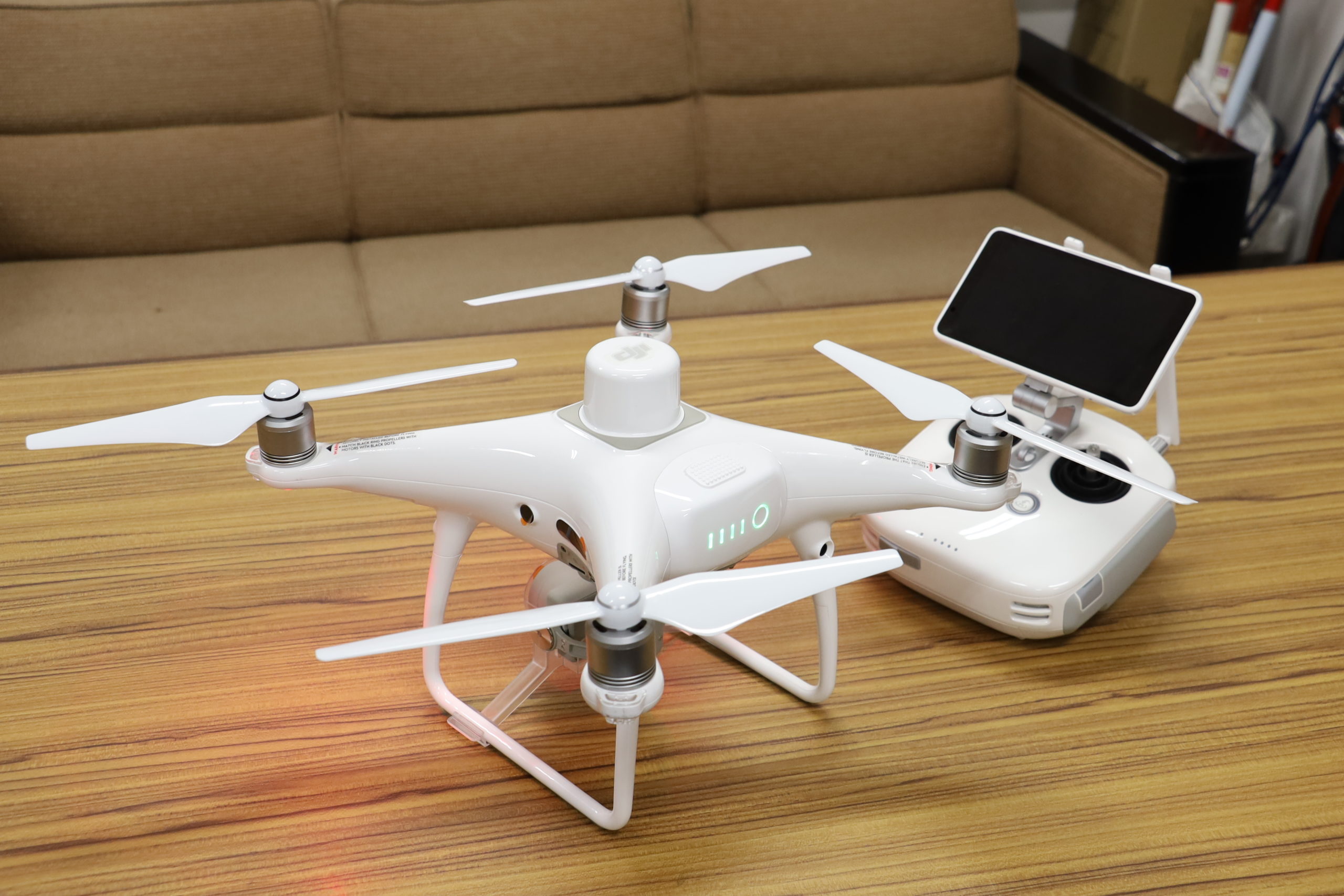
UAV used for disaster investigation and research: Phantom 4 RTK of DJI Co., Ltd. By communicating with a base station in real time, aerial photo data with location information can be obtained and high-precision topographical data can be created
“We want to know what the local community really needs and get the word out about the presence of the Center by responding to such needs,” says Director Yamada. Development of guidelines on planning for the mitigation of widespread natural disaster with multiple hazards in cooperation with relevant government authorities is a major goal of the Center. Furthermore, there is a plan to establish a universal model and export it overseas as a disaster-prevention package. The germ of cooperation with local governments and residents is growing steadily toward the outreach of the Center’s achievements.
This article was published in the Spring 2020 issue of Litterae Populi. The full list of articles can be found here.